Responsible: WidePilot
Involved partner: CMCC, ENSU
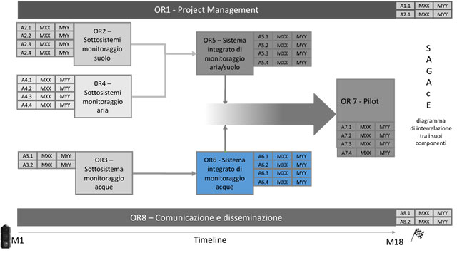
This WP concerns the implementation of an integrated water monitoring system.
Act.6.1: Development of the high resolution model with unstructured grids based on the SHYFEM code. The model will be developed to reach tens of meters resolution in the identified hot spots. The system will use a further innovative approach for the forecasting models based on Topological Data Analysis (TDA).
Act.6.2: The SHYFEM model will be used to reconstruct the last stretch of the Ofanto river, describe its estuarine dynamics and reconstruct the polllutants spill into the sea with Lagrangian modeling.
Act.6.3: Based on the results of the dispersion modeling, sedimentological and morphological characteristics of the beach and the seabed, distribution of sedimentary environments, morphological characteristics of the rocky coasts, wave penetration capacity, coastal areas where it is most likely a high distribution of pollutant concentrations will be evaluated, allowing the elaboration of hazard maps and the development of the DSS thanks to topological analysis.
Act.6.4: The platform will offer different communication possibilities and will be used for data collection of the monitoring network developed in WP3, the visualization and archiving of analytical parameters.